The Perfect Big Sur Weekend Itinerary: Two Days in this Iconic Coastal Destination
Big Sur is easily one of my favorite destinations in California (and as a California native, I’ve seen a lot of the Golden State!). If you’re craving an outdoor escape filled with amazing hikes, stunning rocky beaches, and picturesque coastal views, this iconic Central coast destination is the place to be.
I’ve been lucky enough to spend plenty of time exploring Big Sur, seeing the best of the area up and down the Pacific Coast Highway. This means I know exactly how to put together a comprehensive itinerary that covers the must-sees in the region. Here is my complete itinerary for the perfect Big Sur weekend getaway.

Quick note: this page contains affiliate links, which means I may earn a small commission if you click on the URL and make a purchase (at no cost to you!). As an affiliate, I only recommend services and products from trusted partners I have thoroughly vetted and can genuinely recommend. Thank you!
Want to See the Best of California?
Sign up for monthly newsletters and to get my FREE local’s guide on must-visit destinations in Southern California & the Central Coast!
The Ultimate Big Sur Weekend Trip: 2-Day Itinerary
This Big Sur itinerary covers more of the northern section of the region on the first day, and then some of the main attractions further south on the second day.
Generally speaking, the stops in each day can be rearranged depending on what makes most sense for where in the area you are staying. I just recommend ensuring your stops at McWay Falls and Pfeiffer Beach are sometime in the afternoon to just before sunset – they are best enjoyed at this time of day!
Travel Tip: A Car is a Must!
A car is essential for getting around Big Sur, as there isn’t an extensive public transportation system. If needed, I recommend booking a car through Expedia.
Psst – my Big Sur travel guide goes into more of the key information and helpful tips that you should know before your visit!
Day 1 Itinerary: Point Lobos, Garrapata, Bixby Bridge, Pfeiffer Beach & More
On the first day of your weekend in Big Sur, you’ll start by hiking through Point Lobos, and then stopping at other iconic sites before ending your day at the famous Pfeiffer Beach.
For this day, I recommend bringing lunch with you and enjoying it at Garrapata State Park or one of the viewpoints, as there aren’t any places to eat near the first stops of the day.
Alternatively, after Garrapata, you can drive to The Restaurant at Big Sur River Inn, the Burrito Bar (also at Big Sur River Inn), or The Village to grab lunch. From there, you can either back track to the viewpoints after lunch, OR go right to Pfeiffer Beach, and then see the viewpoints on your way back north (the latter works well if you’re staying in Carmel or Monterey!)
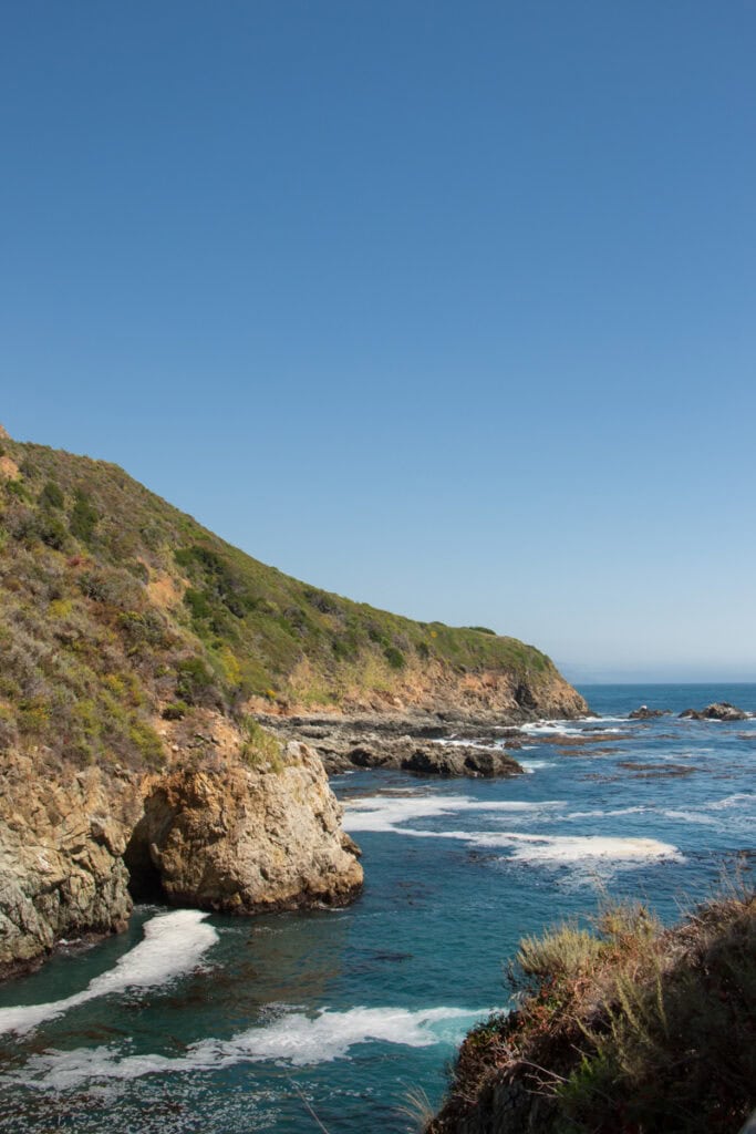
Explore Point Lobos Reserve
While not technically part of Big Sur, Point Lobos State Natural Reserve is a must-visit when exploring the region. Located on the south end of Carmel-by-the-Sea (and just north of Garrapata State Park, which is the northernmost park in Big Sur), this natural reserve is known as the crown jewel of the California State Park system.
You can easily spend a whole day in Point Lobos, but with limited time, I recommend doing the Bird Island Trail (which is just under a mile long). This easy hike takes you to an overlook of China Cove, which is one of the most famous spots in the reserve. It leads you around the cove, and offers stunning views of the coastline.
While you are in the reserve, I also suggest driving over to do the Cypress Grove Trail, which is also just under a mile. It takes you through a gorgeous forest of cypress trees, and offers a beautiful look at the rocky coast.
You’ll pay a day use entrance fee when you enter Point Lobos. This day use pass will be applicable to all other spots you visit on this day, with the exception of Pfeiffer Beach. Be sure to leave it taped up on your window when you park!
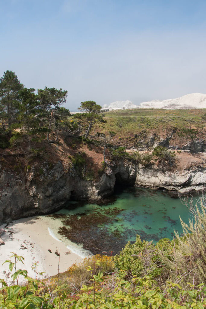
Cypress Grove Trail | China Cove
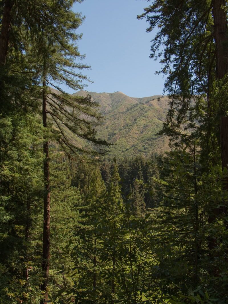
Hike in Garrapata State Park
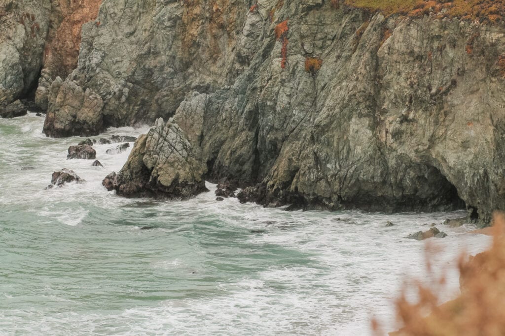
After Point Lobos, drive about 10 minutes down the Pacific Coast Highway (AKA Highway 1) to Garrapata State Park, where you’ll enjoy another easy coastal hike.
The Soberanes Point Trail (which is a 1.6 mile loop) takes you along the seaside cliffs, offering sweeping views of the rocky beaches and beautiful coastline. It’s also a great spot to see wildflowers in the spring and summer. This trail will lead you up to Whale Peak, where you get even better vistas of the landscape.
For this trail, you will park on the PCH – either near Gate 8 or Gate 9. The trail is accessible from both spots.
Alternative Option for a Late Winter to Early Spring Visit
If you’ll be in Big Sur sometime between late January to mid-April, I recommend replacing the Soberanes Point Trail hike with a stop at Calla Lily Valley, which is also located in Garrapata State Park. Calla lilies are in full bloom in the region during this time of year, and this valley is one of the best places to see them. I recommend the Garrapata Beach Calla Lily Valley Trail, an easy loop that is just under a mile long.
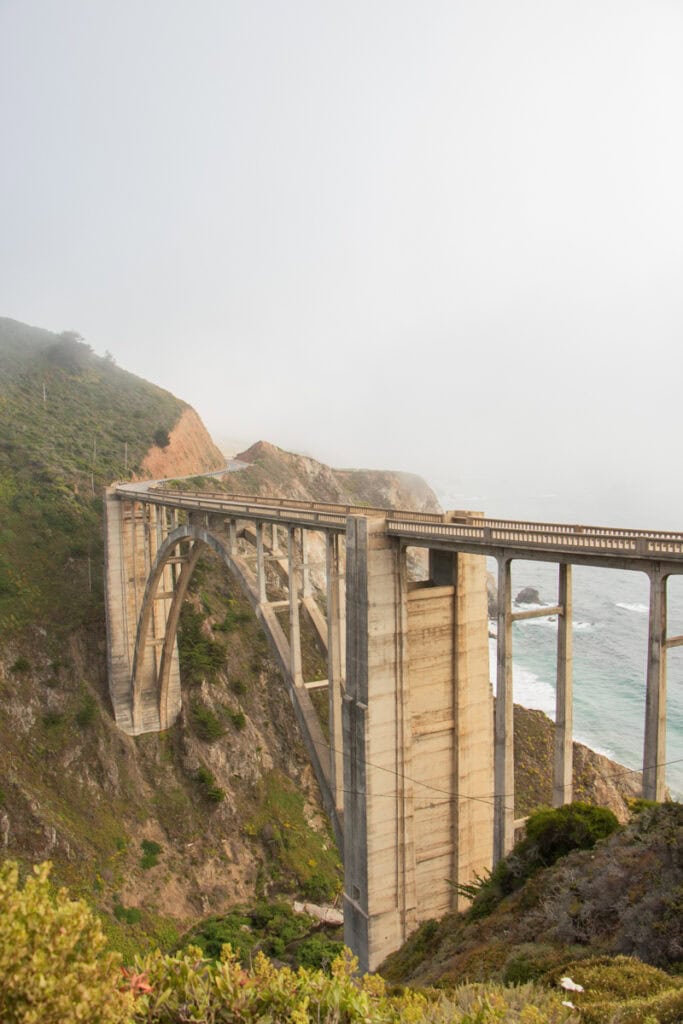
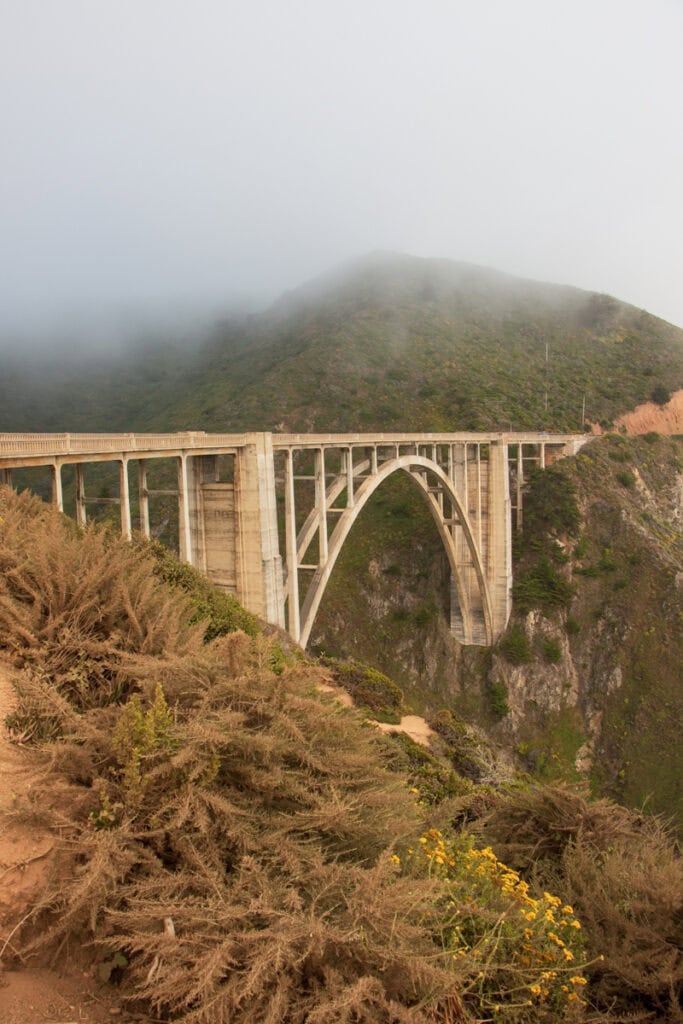
Take in the View of Bixby Bridge
Once you’re done at Garrapata, drive another 10 minutes down the Pacific Coast Highway and stop at the Castle Rock Viewpoint (AKA the Bixby Bridge Vista Point). This is where you’ll get that picture-perfect view of Bixby Bridge, a famous, towering concrete bridge that dates back to the 1930s.
In addition to viewing the bridge from this viewpoint on the west side of the road, you can cross the road and see it from Coast Road. This is where you can see the opposite side of the bridge.
Stop at the Great Sur and Little Sur River Beach Vista Points
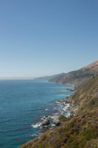
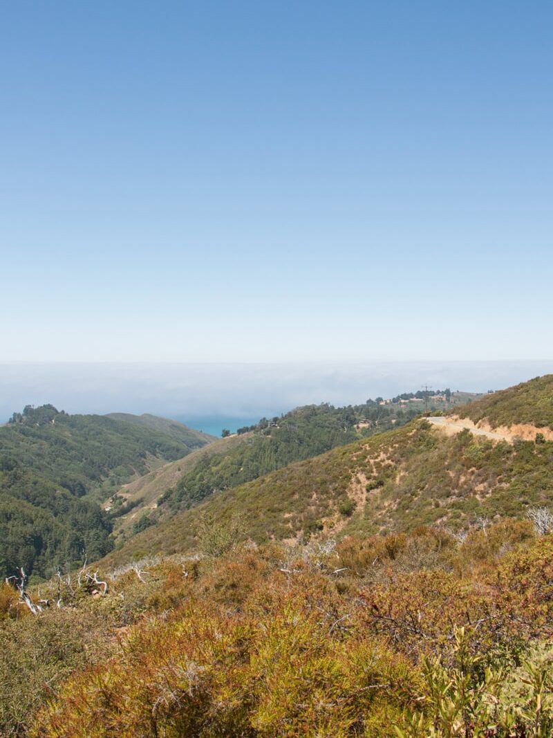
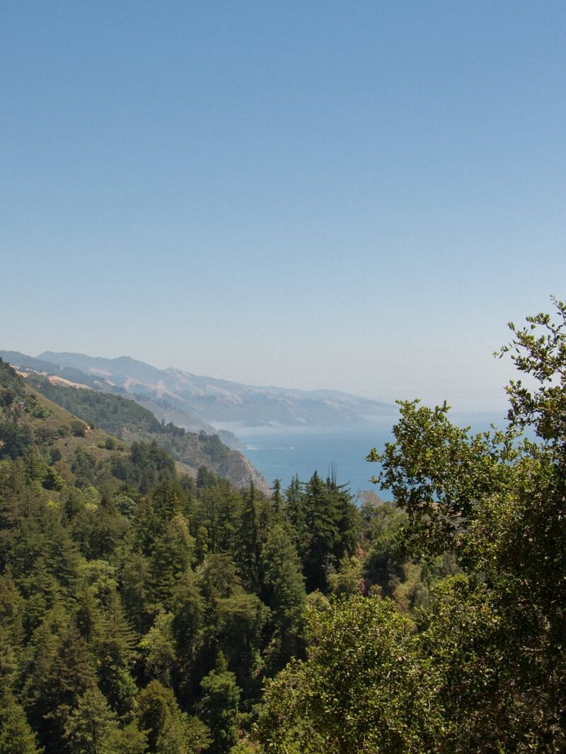
Great Sur Vista Point is hands-down one of my favorite Big Sur viewpoints – and a must-add to your itinerary! This viewpoint (which is just about a 5-minute drive south of Bixby Bridge) is situated high above the water, and you’re able to see for miles down the gorgeous coastline.
I also love the view from the turnout just south of Little Sur River Beach. This turnout is less than 5 minutes from the Great Sur Vista Point, and is much closer to sea level. It offers particularly beautiful views of the beach and the Santa Lucia Mountains when looking north.
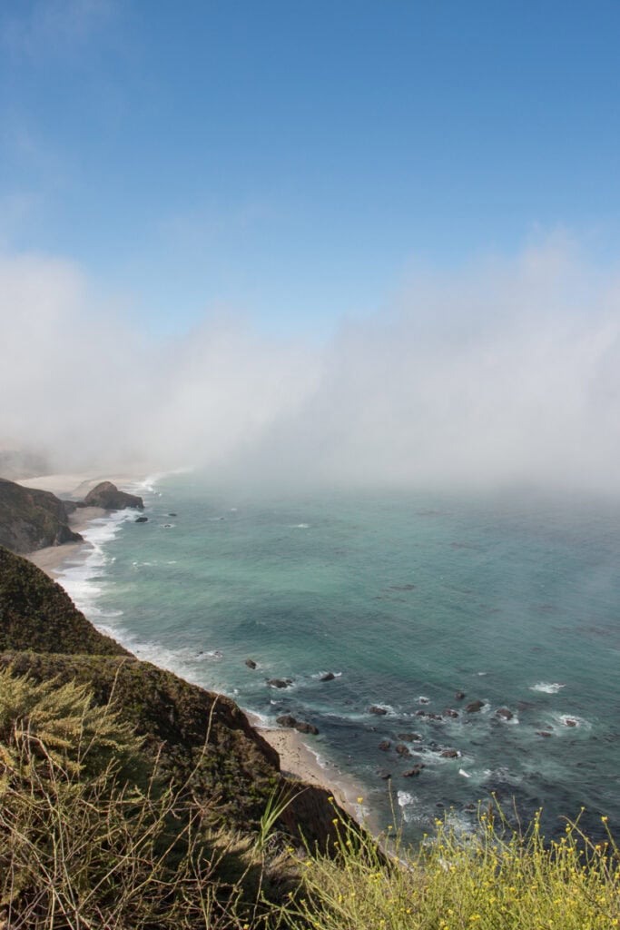
Great Sur Vista | Little Sur River Beach
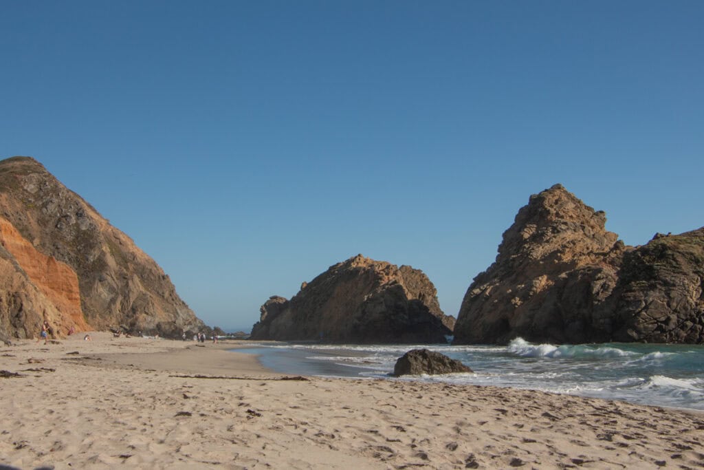
Spend the Rest of the Day at Pfeiffer Beach
After taking in the view from these vista points, you’ll drive for about 25 minutes and make your way to Pfeiffer Beach.
This is one of the most iconic beaches in Big Sur, and is known for its giant rock formations. It’s also the perfect place to catch the sunset! Hang out on the sand, dip your toes in the water, and enjoy the scenery as the sun goes down.
This beach is operated by Los Padres National Forest, and isn’t part of one of the California State Parks. You’ll have to pay a separate day use fee at the staffed kiosk to visit.
Note: to get to Pfeiffer Beach, you’ll drive for about two miles down Sycamore Canyon Road. It gets narrow at some points, so be wary of cars going in the opposite direction as you drive down.
Enjoy Dinner in Big Sur
If you’ll be staying in the area for dinner, here are a couple restaurant recommendations near Pfeiffer Beach:
- The Restaurant at Big Sur River Inn – a rustic restaurant on the Big Sur River
- Big Sur Taphouse – a casual spot with excellent food and a great beer selection
- Sierra Mar at Post Ranch Inn – a fine dining restaurant with breathtaking coastal views (reservations required)
Day 2 Itinerary: Pfeiffer Big Sur, Nepenthe, Partington Cove, McWay Falls, & More
On the second day of your two days in Big Sur, you’ll hike underneath beautiful redwood trees, enjoy another coastal trail, and make your way to McWay Falls – one of the most iconic sites in the region!
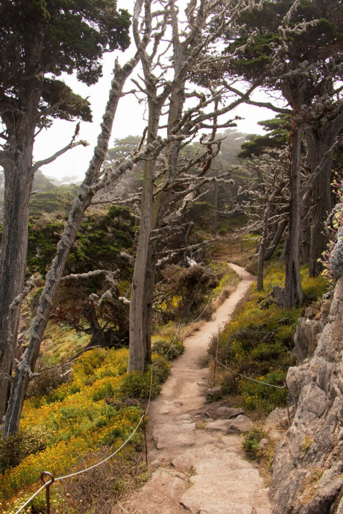
Hike at Pfeiffer Big Sur State Park
There’s so much beauty in coastal Big Sur, but the scenery is equally as stunning when you go a bit inland! In Pfeiffer Big Sur State Park, you can stroll along the Big Sur River and hike underneath the towering redwood trees. While you’re in the park, I recommend checking out one of these trails, depending on your hiking preferences:
- Buzzards Roost to Liewald (1.7 Miles, Easy): For an easier stroll, try this out-and-back trial. It goes along the Big Sur River, underneath a gorgeous forested area.
- Pfeiffer Falls Trail (1.7 Miles, Moderate): This out-and-back trail takes hikers through a forested area, ending at Pfeiffer Falls. Before going, I recommend checking recent AllTrails reviews to confirm the water levels at the falls.
- Buzzards Roost Trail (2.9 Miles, Moderate): This loop trail leads hikers underneath a dense forest of redwood trees. You’ll make your way up to a viewpoint, where you’ll get a vista of the ocean and the Santa Lucia Mountains. I personally like the first mile of this trail (where you’re hiking amongst the redwoods) the best. If you want to hike through redwoods but aren’t quite up for the full hike, I suggest hiking until you get above the treeline, and then turning around.
The trailheads for these hiking trails are all located near each other. You can park at one of the day use parking lots in the park, and then walk over to the trailhead. You’ll also be able to purchase your day use pass (which you can use for the other parks in this day’s itinerary) when you drive through the staffed park entrance kiosk.
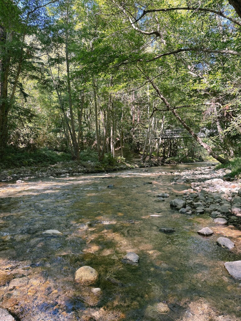
Buzzard’s Roost Trail | Buzzard’s Roost Trail Vista | Big Sur River
Stop by the Redwood Deck
Before leaving Pfeiffer Big Sur, be sure to do a quick stop at the Redwood Deck (located right next to Big Sur Lodge). At this spot, you’ll be able to get a closer look at some of the largest redwood trees in Big Sur.
Explore Hawthorne Gallery or Henry Miller Memorial Library
Take a moment away from the outdoor adventures to stop by one of these popular Big Sur spots (both of which are less than a 10 minute drive south of the Pfeiffer Big Sur trails).
The Henry Miller Memorial Library is a non-profit bookstore and event venue that honors Henry Miller’s work. This quaint library is nestled between redwood trees, and is the perfect spot to pick up a new book to read.
Alternatively, head to Hawthorne Gallery and take a moment to admire some art. The gallery is home to a variety of pieces across different mediums, and features works by local artists (including members of the Hawthorne family).
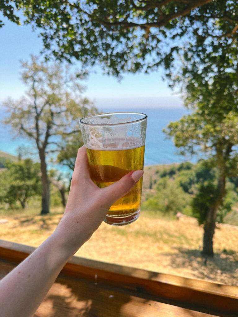
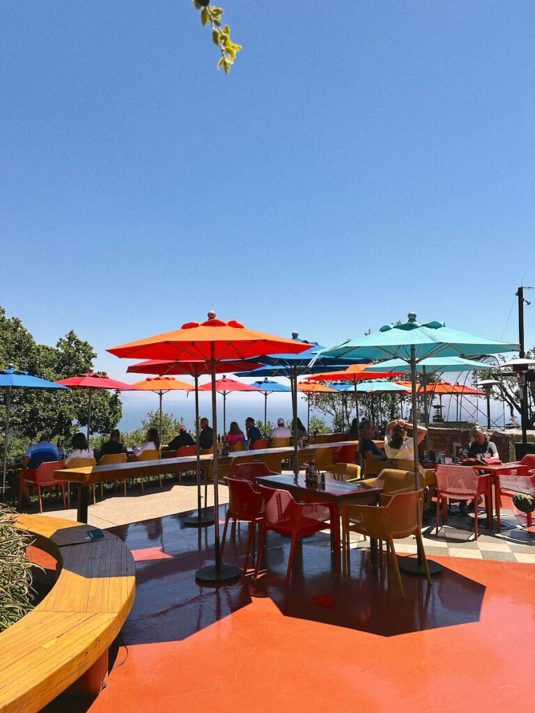
Enjoy Lunch with a View at Nepenthe
When you’re in Big Sur, I highly recommend prioritizing a visit to Nepenthe for lunch. One of the most loved restaurants in Big Sur, this eatery is situated high above the water, offering remarkable views of the coast. There’s an expansive outdoor patio (as well as an indoor dining space with plenty of large windows), so you can enjoy your meal as you take in the view! I suggest getting some post-hike fries to share.
Nepenthe is popular, so there’s a good chance you’ll need to wait for a table (and they don’t take reservations). During my last summer weekday visit, the wait for two people was about 20 minutes. If the wait is too long, you can also eat at Cafe Kevah, another restaurant on the property. It’s right below Nepenthe, and also offers beautiful views.
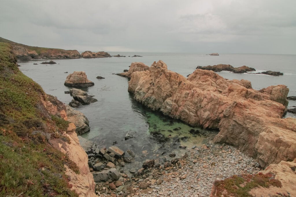
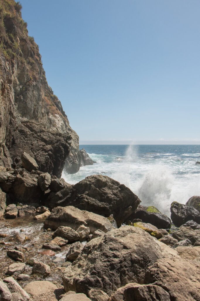
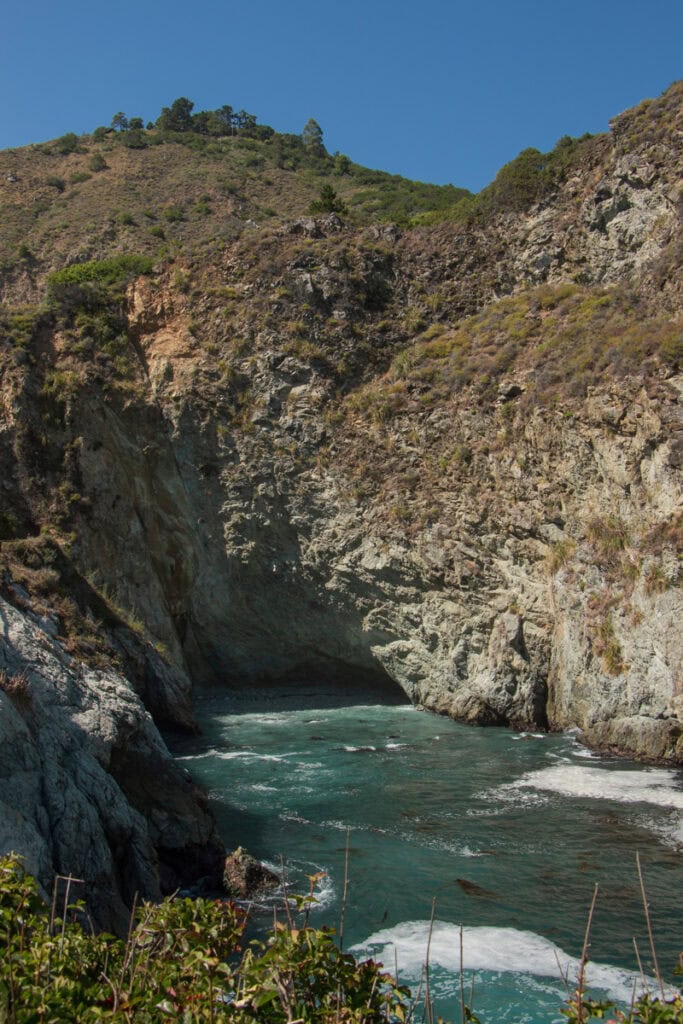
Hike Down to Partington Cove
After lunch, drive about 10 minutes down the Pacific Coast Highway and stop at the Partington Cove Trail for your second hike of the day. This moderately rated trail (which is just over a mile long) splits into two parts. The first off-shoot takes you along a creek and down to a rocky beach. After visiting the beach, you’ll make your way back up the trail and go through a tunnel out to Partington Cove.
Note that there isn’t a parking lot at the trailhead, so you’ll street park on the PCH.
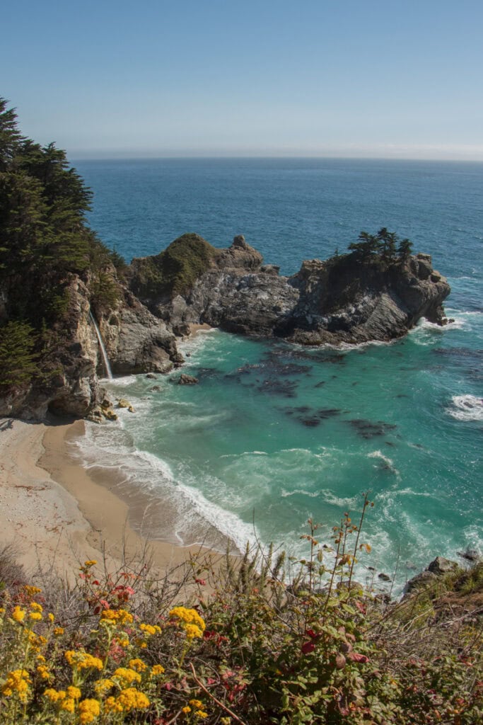
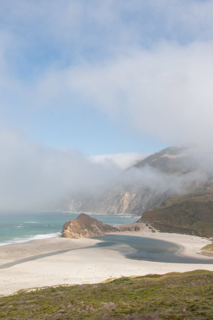
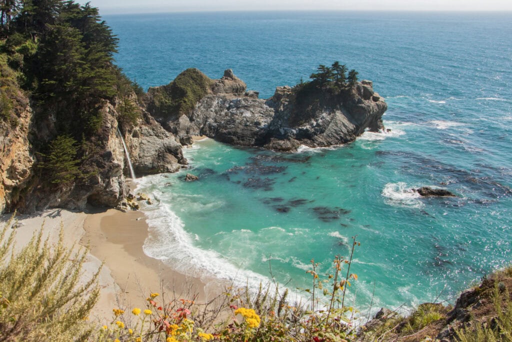
Check Out the Iconic McWay Falls
End your Big Sur trip on a high note by stopping at one of the most famous spots in Big Sur: McWay Falls (located in Julia Pfeiffer Burns State Park). The afternoon is a perfect time to visit, as the sun will be shining right on the falls!
To get to the falls, park your car in the lot on the east side of Highway 1. The very short (less than half a mile) McWay Falls Trail starts at this parking lot. It takes visitors underneath the highway through a tunnel, and then out to the vista where you can see the falls.
The trail out to the falls is sometimes closed. You can check the Julia Pfeiffer Burns State Park website for current closure info. Don’t worry…if it is closed, you can still see McWay Falls from Highway 1!
There is a pullout spot a couple hundred feet north of the McWay Falls parking lot entrance. Of course, be cautious when parking and stay mindful of cars on the road.
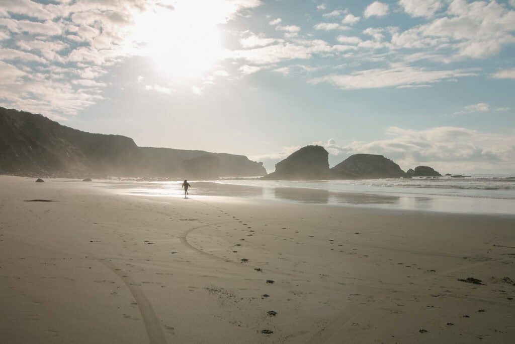
Optional Stop If Time Permits: Sand Dollar Beach
If you have the time before you head back home, I highly recommend continuing to drive south down Highway 1 to visit Sand Dollar Beach. The drive from McWay Falls is about 35 minutes.
As you might expect, the drive itself is beautiful, and there are many great viewpoints along the way, including Big Creek Cove Vista Point and Gamboa Point.
Sand Dollar Beach is an expansive beach with really cool tide pools. It’s also a great place to watch the sunset!
There is a parking lot on the cliffs above the sand. The beach is operated by Los Padres National Forest, so there’s a $10 fee per car for a day use pass. A day use pass for the other state parks isn’t applicable here.
Additional Things To Do In Big Sur
Of course, there is so much more to do in Big Sur and the surrounding area. Within the region, some additional things to do include:
- Enjoy a Longer Hike: I included shorter hikes in this itinerary to ensure you get to see as much of the region as possible, but there are plenty of longer trails if that’s more your speed! Some options include Creamery Meadows, Bluffs, Panorama, and Ridge Trail Loop (8 miles), Tanbark Trail and Tin House Loop (6.7 miles), and Soberanes Canyon and Whale Peak Loop (4.1 miles).
- Explore Andrew Molera State Park: This state park is another great place to check out if you want to do more coastal hikes and spend extra time by the water. The Creamery Meadows Trail (2.3 miles) is a great hike to check out – it takes you right down to the beach!
- Explore Limekiln State Park: This state park is located on the southern end of Big Sur. A really cool trail worth hiking is the Hare Creek and Limekiln Trail, a 2.1-mile trail that leads through a forested area, over to ruins of 1800s lime kilns.
- Tour the Point Sur Lighthouse: If you are looking for more unique activities in Big Sur, consider doing a tour of the Point Sur Lighthouse (located in Point Sur State Historic Park).
Where to Stay in Big Sur
If you decide to stay in Big Sur for your visit (rather than making nearby Carmel or Monterey your home base), there are some great hotels in the area, including the following:
- Big Sur River Inn – a well-loved and decently priced (for the area!) 3-star hotel
- Big Sur Lodge – a popular 3-star hotel that is conveniently located right in Pfeiffer Big Sur State Park
- Alila Ventana Big Sur – an all inclusive luxury 4-star resort
- Post Ranch Inn – a bucket list-worthy 5-star luxury resort
Alternatively, you can choose to stay in Carmel or Monterey, and then drive into Big Sur each day. Carmel is about a 15-minute drive from the northernmost part of Big Sur, while Monterey is a 20-minute drive.
As you are planning your trip to Big Sur, be sure to read through these travel guides:
- The Complete Big Sur Travel Guide: What You Need To Know For Your Visit
- Where to Stay in Big Sur: Best Areas + Hotel Recommendations
- Big Sur Packing List: Everything You Need While Exploring The Rugged Coast
- The Best Time To Visit Big Sur: Season-By-Season Guide
- The Best Things to do in Big Sur, CA
- The Best Big Sur Viewpoints To Add To Your Itinerary
- Point Lobos State Natural Reserve: Where To Hike & What To Know Before Visiting
If you plan on exploring more of the Central Coast, take a look at my Cambria and Carmel guides: