The Ultimate Big Sur Day Trip Itinerary: Perfect for First-Time Visitors
If there is one destination that should be on everyone’s California travel bucket list, it has to be Big Sur. Known for its sweeping coastal vistas and natural, rugged beauty, I think everyone should spend some time driving down the Pacific Coast Highway and exploring the area.
As someone who has visited multiple times, I’ve put together the ultimate Big Sur day trip itinerary. In this itinerary, you’ll go on some easy hikes, see some of the most iconic sites in the region, and enjoy taking in the beauty of the area!
Quick note: this page contains affiliate links, which means I may earn a small commission if you click on the URL and make a purchase (at no cost to you!). As an affiliate, I only recommend services and products from trusted partners I have thoroughly vetted and can genuinely recommend. Thank you!
Want to See the Best of California?
Sign up for occasional newsletters and to get my FREE local’s guide on must-visit destinations in Southern California & the Central Coast!
Is One Day Enough for Big Sur?
Big Sur spans over more than 70 miles of the Central Coast in California, and there are multiple state parks within the region. Given how expansive it is, you definitely aren’t going to see everything with just one day. But don’t worry – you can still pack in a lot, and can see some of the most iconic sites in a day!
My advice: make sure you are truly giving yourself a full day to explore the region. A half day isn’t going to cut it here, especially given how much driving you’ll need to do. Plan to get out early (I’d say arrive at the first stop no later than 9am) so that you have plenty of time to see as much as possible.
Quick Tips for Visiting Big Sur
My Big Sur travel guide goes more in-depth into what you need to know before visiting the area, but here are some key things to keep in mind:
- Cellular service is very limited. I recommend downloading Google Maps for offline use ahead of time so that you can easily navigate the area.
- Road closures are common in Big Sur, largely due to rock slides and environmental damage. Before your visit, refer to CalTrans for the most current info on road closures.
- A car is essential – there isn’t any sort of public transportation in the area! If you need a vehicle, I recommend booking a rental car through Expedia. You can compare prices from major rental companies to find the best deal. Alternatively, you can book a top-rated private charter to Big Sur, which is suitable for up to six people. They’ll pick you up from the Monterey/Carmel area, and take you wherever you want to go in the region.
- Come with a full tank of gas, and plan to fill up in Monterey and Carmel before you hit the road. Prices are cheaper in these towns compared to Big Sur!
- Bring along water-resistant sunscreen, layers (it gets chilly in the morning and evening, even in the summer!), snacks, and plenty of water. I also recommend wearing good-quality hiking boots or comfortable athletic shoes.
How to Spend One Day in Big Sur
In order to help you make the most of your quick trip, this itinerary includes the must-see spots in Big Sur, including McWay Falls and Bixby Bridge.
I’ve also included a couple cool stops that I think everyone (especially first time visitors!) should see to fully experience the beauty of the area. You’ll do a couple low-key hikes, take in the scenery from some incredible viewpoints, stop by a famous beach, and more!
Note: this itinerary starts on the north end of Big Sur, and then takes you about 30 miles down the Pacific Coast Highway, stopping by some of the most iconic spots in the region along the way. You’ll then turn around to make your way back north, doing one final stop before returning home.
Do an Easy Coastal Hike in Garrapata State Park (Or Check Out the Seasonal Calla Lily Blooms)
Start off your day trip by doing a low-key coastal hike in Garrapata State Park (the northernmost park in Big Sur). The Soberanes Point Trail is an easy 1.6-mile loop trail that takes hikers along the coastal cliffs in the park. Expect to see beautiful wildflowers if you’re visiting in the spring or summer!
As you continue on the trail, you’ll make your way up to Whale Peak, where you can get an amazing view of the park and the coast.
For this trail, you’ll street park on Highway 1. You can either park near Gate 8 or closer to Whale Peak. The trail is accessible from both spots.
Planning on visiting sometime between late January to mid-April? Consider yourself lucky – you’re visiting at the perfect time to experience the calla lily blooms! Instead of doing the Soberanes Point Trail, I recommend visiting Calla Lily Valley (also located in Garrapata State Park) to see these flowers in bloom. The Garrapata Beach Calla Lily Valley Trail is an easy loop trail that is just under a mile long. It takes you to the picturesque valley, and will also lead you down to the beach. You’ll street park near the trailhead.
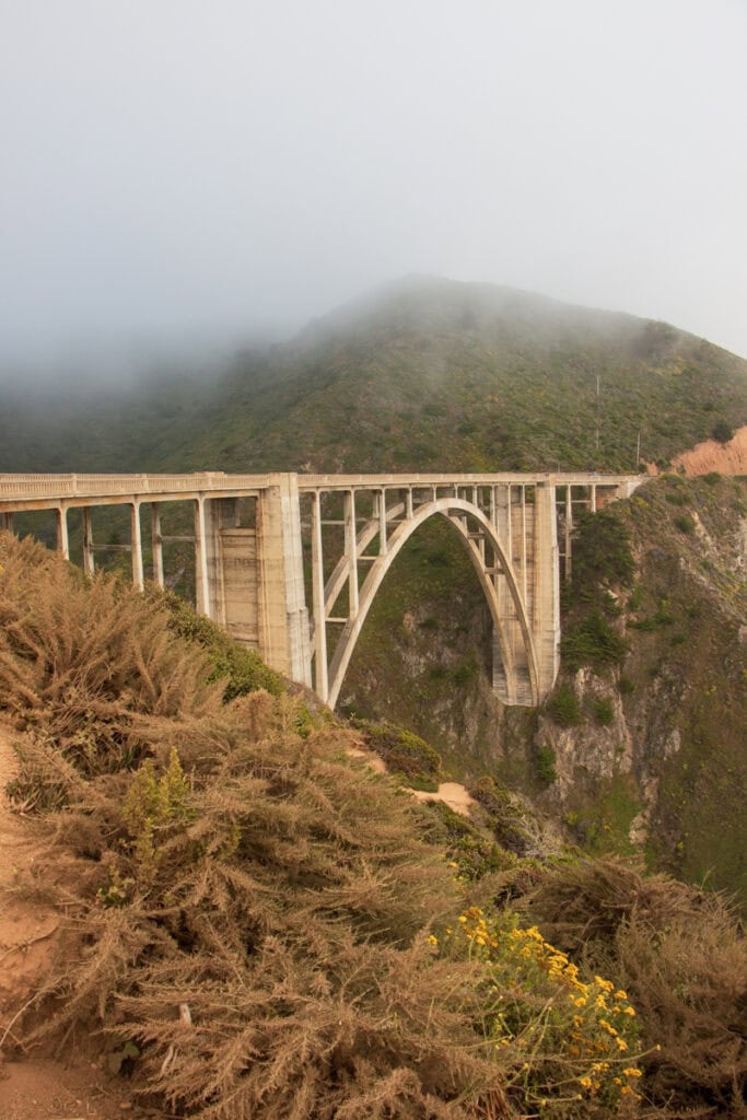
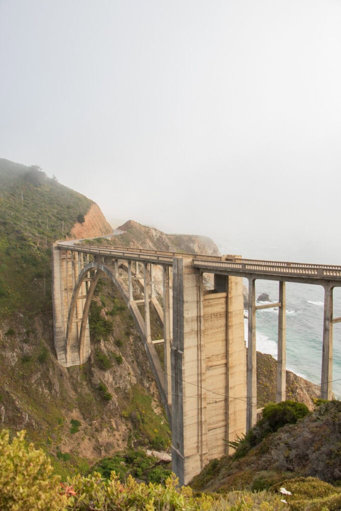
Check Out Bixby Bridge
Get back in your car and drive south down the PCH to Castle Rock Viewpoint – the viewpoint where you can see Bixby Bridge. This famous concrete bridge dates back to the 1930s, and is the tallest of its kind. There are a few street parking spots right next to the viewpoint.
For a slightly different vantage point, you can also park on Coast Road (which is a dirt road, located on the other side of the PCH). From here, you can get a view of the opposite side of the bridge.
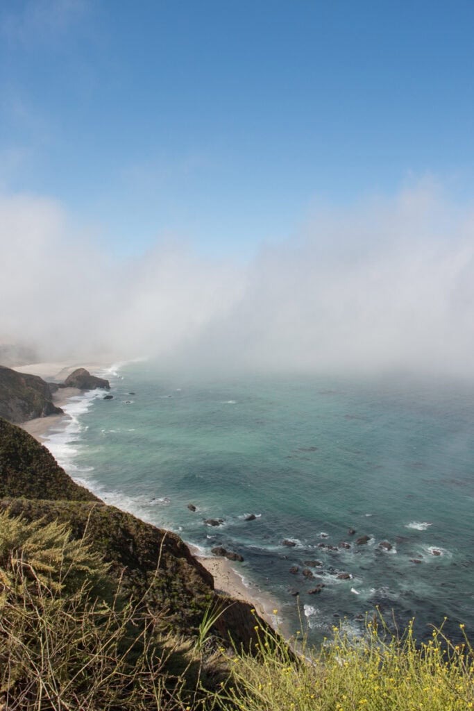
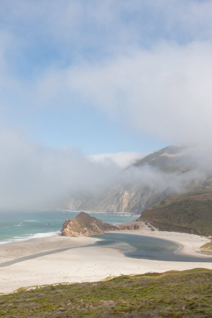
Take in the View from the Great Sur & Little Sur River Beach Vista Points
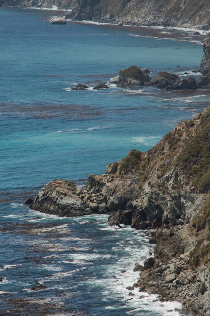
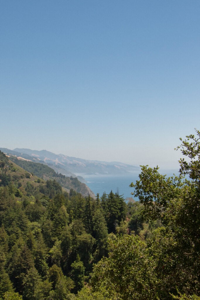
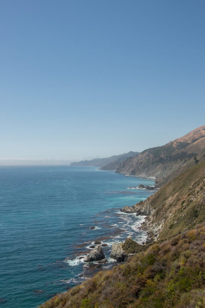
Drive about two miles down the road to make your way to the Great Sur Vista Point (one of my favorite viewpoints in Big Sur!) for a quick stop to take in the view. Situated high up on a coastal cliff, you get absolutely stunning views of Little Sur River Beach down below, as well as the entire coastline.
I also recommend stopping at the turnout just south of Little Sur River Beach. This spot is less than 5 minutes from the Great Sur Vista Point, and is much closer to sea level. It offers beautiful views of the beach and the Santa Lucia Mountains when looking north.
See the Redwoods in Pfeiffer Big Sur State Park
Get away from the coast for a moment and make your way to the Redwood Deck in Pfeiffer Big Sur State Park, which is located about 11 miles south of the Great Sur Vista Point.
This area allows you to get up close to some of the largest redwood trees in Big Sur. There are some benches on the deck, so you can take a moment to rest as you look up at the trees.
If time permits, you may want to hike the easy Buzzards Roost to Liewald Trail (1.7 miles), which goes along the Big Sur River and through the beautiful forest. A more challenging option is the Pfeiffer Falls Trail (1.7 miles), which ends at a waterfall. I recommend checking recent AllTrails reviews to confirm the water levels at the falls.
Pfeiffer Big Sur State Park has day use parking lots that are just a short walk from the Redwood Deck. As you enter, you’ll pass through the Park Entrance Kiosk, where you can buy your day use pass (if you haven’t already purchased one). This pass will be valid for parking at any California state parks that you visit during your day trip, so be sure to display it in your vehicle!
Take a Break for Lunch
If you’ve packed a lunch, I recommend enjoying it at the benches on the Redwood Deck. Otherwise, there are some great lunch options in Big Sur that are a short drive south of the Redwood Deck, including the following:
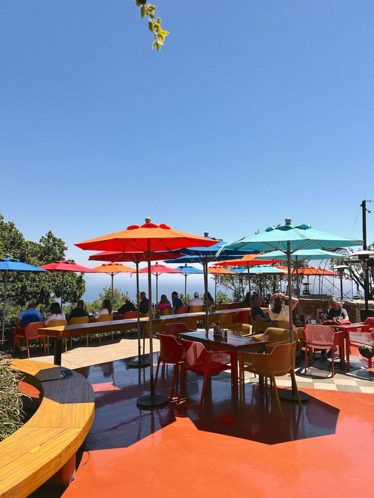
- Nepenthe: For lunch with a view, it doesn’t get better than Nepenthe (pictured below). The casual restaurant (which serves burgers, sandwiches, and salads) is situated high above the coast, and has an amazing outdoor patio where you can get incredible views of the area. Nepenthe is popular, and you may have to wait a bit for your table. They don’t take reservations. If it’s a little too crowded, there’s also another outdoor eatery on the property called Cafe Kevah that sits right below Nepenthe.
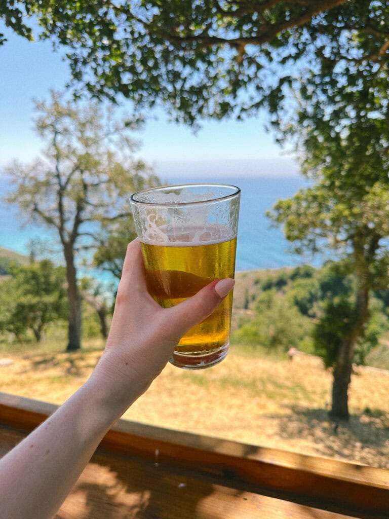
- Big Sur Taphouse: Another option is this casual taproom, where they serve tacos, burgers, sandwiches, nachos, and more. Of course, they also have a great selection of beer.
- The Restaurant at Big Sur River Inn: You can also have lunch at this rustic restaurant on the Big Sur River. Menu options include salads, burgers, sandwiches, barbecue entrees, and more.
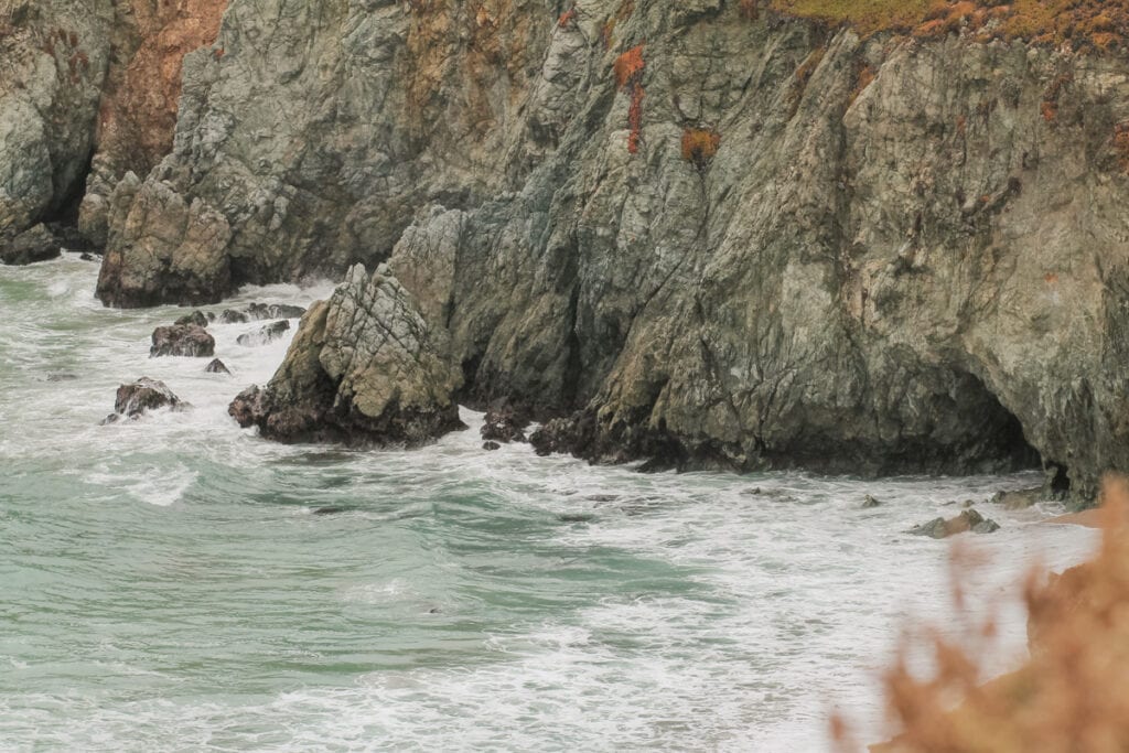
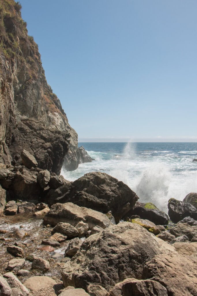
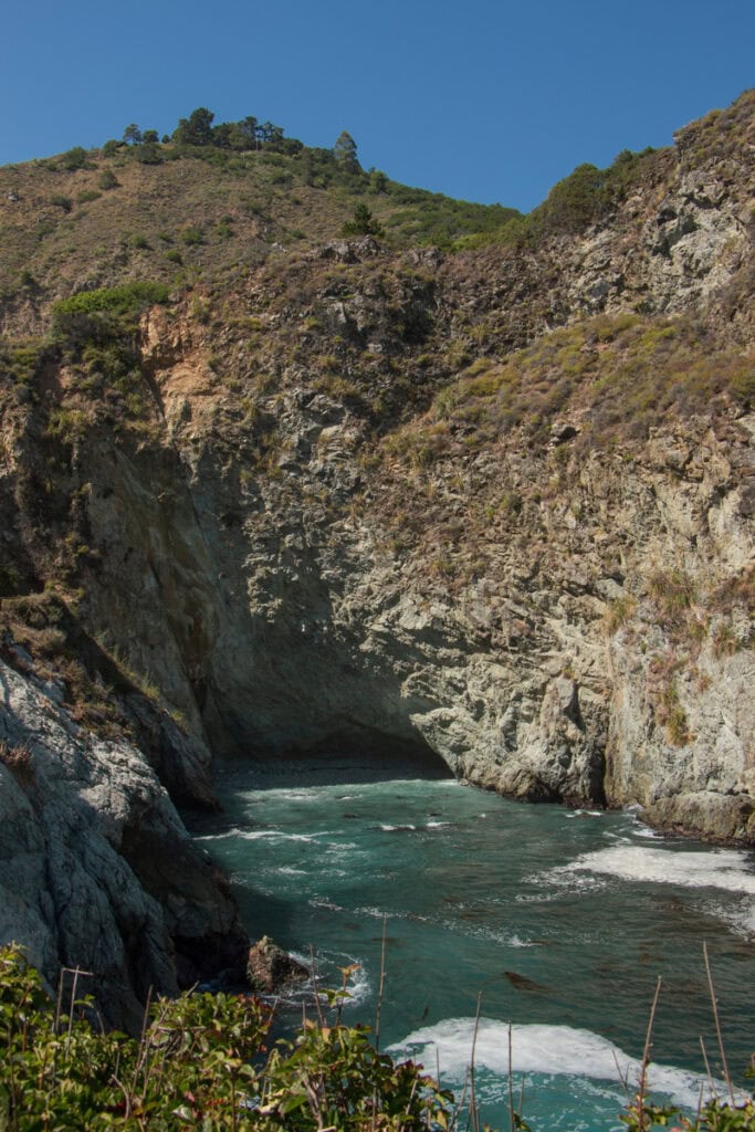
Hike Down to Partington Cove
Next, you’ll do another short hike at Partington Cove, located about six miles south of Nepenthe. The Partington Cove Trail (pictured below center and left) in Julia Pfeiffer Burns State Park is a moderately-rated out-and-back trail that is just over a mile long.
This trail splits into two parts. On the northern part, you’ll hike along a creek that goes down to a rocky beach. After that, you’ll backtrack a bit and hike through a tunnel out to the scenic Partington Cove. Note that this is a fairly easy trail, but there is some elevation gain at the end when you hike back up the road!
There isn’t a parking lot, so you’ll street park on the highway. The trail starts at the green gate.
If you got a later start to the day (or just don’t feel like doing another hike!), you can skip this trail and instead do a quick stop by The California Sea Otter State Game Refuge turnout – another viewpoint with amazing views of the coast. It’s just north of Partington Cove.
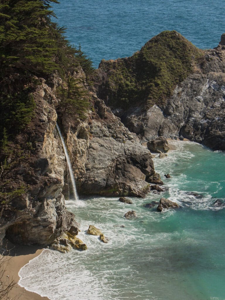
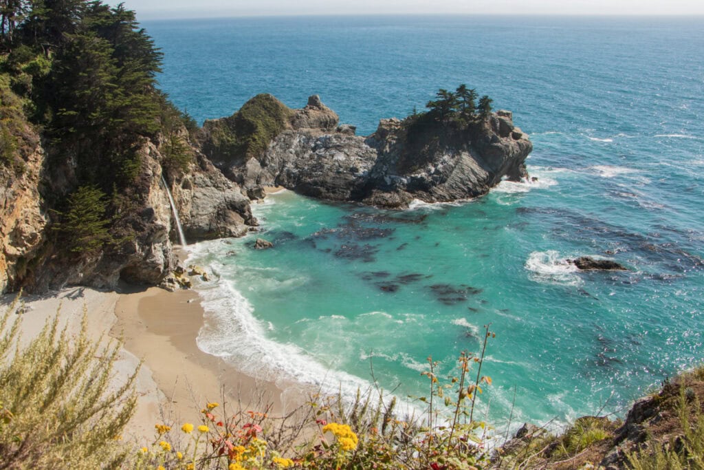
Visit McWay Falls
No matter how short your trip may be, a visit to Big Sur isn’t complete without a stop by McWay Falls, which is also located in Julia Pfeiffer Burns State Park (and about two miles south of the Partington trail).
To see the falls, you’ll park in a parking lot on the east side of Highway 1. You can display the day use pass that you bought when parking at Pfeiffer Big Sur State Park. If you don’t have a day use pass, there is a self-registration box where you can pay to park (be sure to bring cash!).
The McWay Falls Trail starts at this parking lot, taking visitors underneath the highway through a short tunnel. From there, you’ll walk over to the viewpoint where you can see the falls.
This trail is less than half a mile long, and is super easy – there’s no elevation gain. Given how famous this site is, note that it can get crowded!
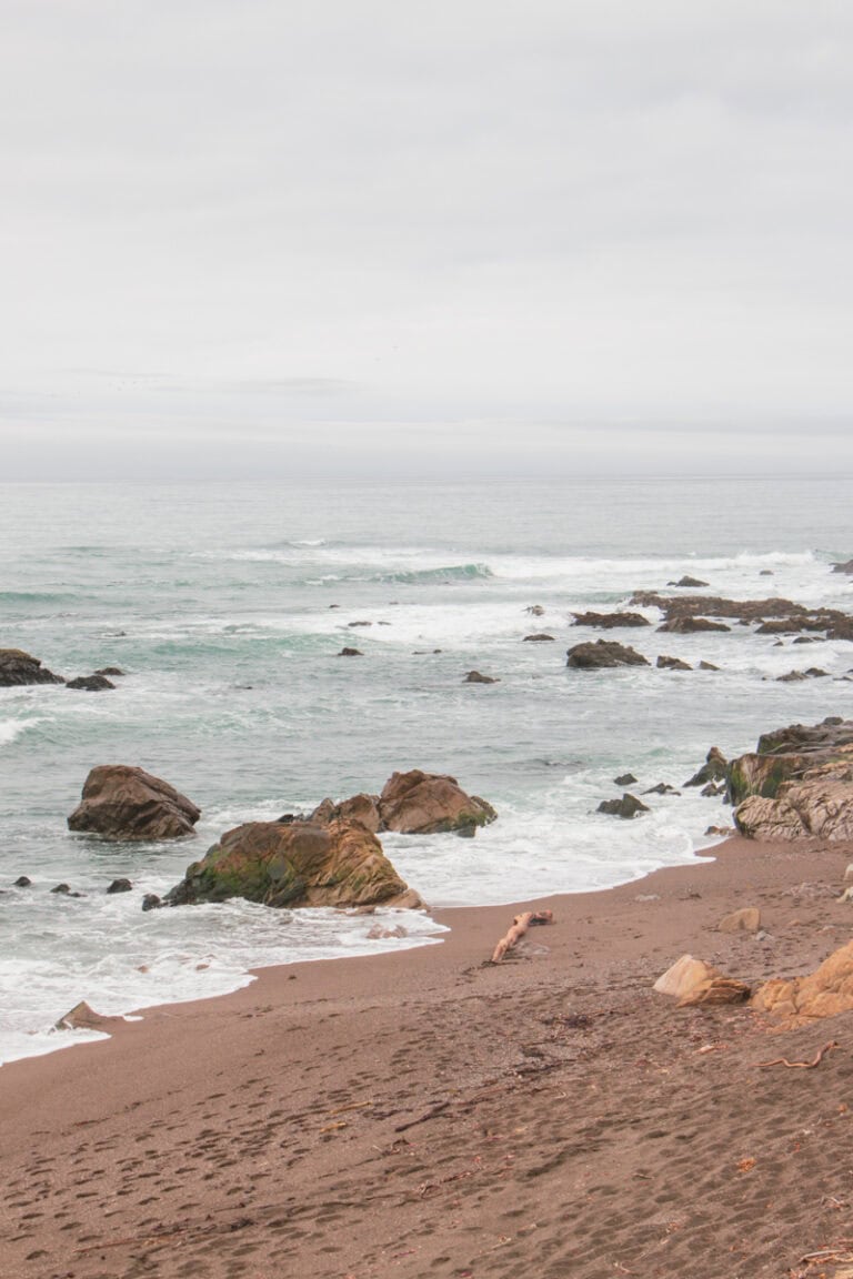
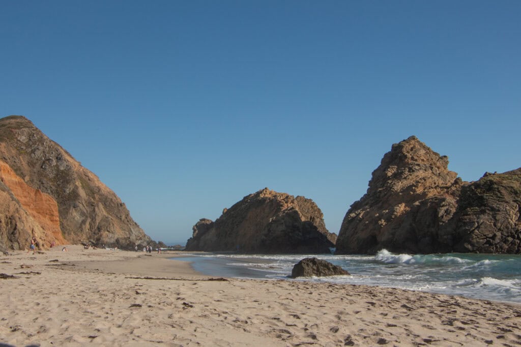
End the Day at Pfeiffer Beach
January 2026 note: Pfeiffer Beach is currently closed indefinitely. If it is closed during your visit (and if time permits), an alternative option is to drive down to Sand Dollar Beach, which is about a 40-minute drive south of McWay Falls. The expansive beach has really cool tidepools, and the drive down is beautiful!
After McWay Falls, you’ll start to make your way back north. If you have enough time (and energy!) after McWay falls, you can end your day trip to Big Sur with one final stop at Pfeiffer Beach – one of the most famous beaches in the area. It’s located about 12 miles north of McWay falls.
Pfeiffer Beach is known for its giant rock formations, and is a great place to catch the sunset! If you’re visiting in the late fall or early winter, you may even get to experience the sun shining right through Keyhole Arch (one of the massive rock formations in the water).
Keep in mind that this beach is operated by Los Padres National Forest. Since it isn’t technically in one of the CA state parks, you’ll have to pay a separate day use fee to park here. There is a staffed kiosk where you can pay.
Important note: to access the beach, you’ll need to drive for two miles down Sycamore Canyon Road, which does get narrow at some points. Be wary of other cars going in the opposite direction as you make your way down to the beach.
Additional Things to do In and Around Big Sur
Of course, there is so much more to do and see in Big Sur. If you want to adjust the above itinerary to fit your interests, some other activities to consider doing in Big Sur include touring the Point Sur Lighthouse, hiking in Andrew Molera State Park, and checking out the Henry Miller Memorial Library.
As you explore the region, here are some additional activities and places to see just outside of Big Sur:
- Check Out Point Lobos Natural Reserve: If you’re craving more time in nature, plan a visit to Point Lobos. This reserve is just a 5-minute drive north of Garrapata State Park in Big Sur, and is known for its stunning coastal views and abundant wildlife.
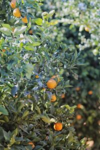
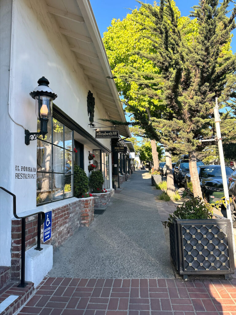
- Visit Carmel-by-the-Sea: Located just a 15-minute drive from the northern edge of Big Sur, this picturesque coastal town is a popular destination to visit. There are plenty of things to do in Carmel, including shopping, enjoying the world-class dining scene, and exploring the pristine beaches. Many Big Sur visitors also choose to stay in Carmel, as there are plenty of hotels and house rentals in town (far more than you’ll find in Big Sur!).
- Explore the 17-Mile Drive in Pebble Beach: Located just north of Carmel-by-the-Sea, this scenic drive is a must-do if you have the time. You’ll make your way through forests of Monterey cypress trees, and will drive along the rocky coast.
- Visit Cambria: If you’ll be traveling south after your Big Sur trip, consider stopping by the laid-back coastal town of Cambria. You can also visit the iconic Hearst Castle, which is just north of Cambria in San Simeon.
Here are some additional Big Sur guides to help you plan your visit:
- The Complete Big Sur Travel Guide: What You Need To Know For Your Visit
- The Best Big Sur Viewpoints To Add To Your Itinerary
- Where to Stay in Big Sur: Best Areas + Hotel Recommendations
- Big Sur Packing List: Everything You Need While Exploring The Rugged Coast
- The Best Time To Visit Big Sur: Season-By-Season Guide
If you’ll be exploring destinations around Big Sur (such as Carmel, Monterey, and Cambria), take a look at these guides:
- The Best Things To Do In Carmel-By-The-Sea, CA
- The Perfect Day Trip To Carmel: A Complete Itinerary
- Where To Stay In Carmel: Best Areas + Hotel Recommendations
- The Ultimate Carmel-By-The-Sea Weekend Getaway Guide
- The Ultimate 3-Day Big Sur, Carmel, And Monterey Itinerary
- The Best Things to do in Cambria, CA: A Complete Guide
- The Complete Hearst Castle Guide: What You Need to Know Before Your Visit